Taylor Point: Maps

Maps are critical to TPRA’s restoration work and to the coordination of our activities. Maps are a key tool for inventorying invasive plants and keeping track of where they grow. Maps also are an ideal medium for documenting our successes and our setbacks in eliminating invasive plants. They are essential to our planning and permitting efforts; useful for organizing our work parties; an effective means of demonstrating the changes in shoreline and habitat types over time; and also provide a focus for our review and redesign of pathways and trails. Maps are generally helpful for introducing the interested members of our community to Taylor Point and highlighting areas of past, current and future restoration activity.
TPRA sponsored an ArcGIS Online Mapping Course for interested participants and enjoyed an enthusiastic turnout from such organizations as the Jamestown Historical Society, the Jamestown Tree Committee, the Conservation Commission, the Harbor Commission, Quononoquott Garden Club, the Jamestown Right of Way Association, and the Jamestown Library Board of Trustees. The class focused on new and interesting ways to collect and display data and images. We learned techniques particularly useful to our preparation of CRMC Coastal Buffer Zone Permit Applications. We expect to sponsor similar courses and related presentations in the future. Such events will be posted on our News and Events page.
The following map presentations provide just a few examples of maps we are using to plan and to document and explain our restoration work at Taylor Point:
“Where is Taylor Point?”;
Story Maps of TPRA Efforts to Control Garlic Mustard and Morrow’s Honeysuckle;
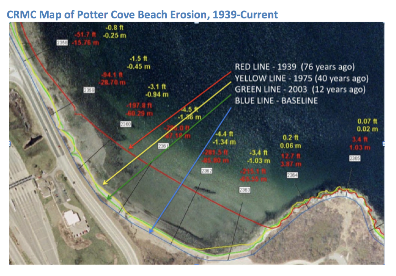
Taylor Point Shoreline Changes over time;
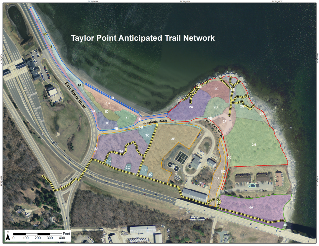
Trails and Paths of Taylor Point;
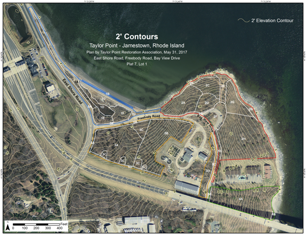
A topographic Map of Taylor Point; and
Maps of the Five Major Habitat Types represented at Taylor Point:
1. Potter Cove Beach
2. Taylor Point Cliffs
3. Black Cherry Woodlands
4. Bridge
5. Roadsides
We intend to post more maps. Check back from time to time for updates and additions.
WHERE IS TAYLOR POINT ?
Story Maps of TPRA Efforts to Control Garlic Mustard and Morrow’s Honeysuckle
Taylor Point Habitat Areas
Shoreline Changes over Time

Trails and Paths at Taylor Point

A Topographic Map of Taylor Point
